
Recently I assisted scientists from the United States Geological Survey (USGS) studying the mangrove ecosystem at a future restoration project on Marco Island. This site comprises a large mangrove die-off area near Fruit Farm Creek, located on San Marco Road between Goodland and the City of Marco. The main cause of the die-off is restricted tidal flow. Although mangroves can tolerate high salt content (“salinity”), it’s still necessary to let water flush in and out of the system to bring in oxygenated, lower salinity water and remove waste material like sulfide. RBNERR and its partners have designed a restoration project would restore water exchange by dredging creeks that have filled in, and opening culverts under the road.
The USGS is studying this system both before and after the restoration so that a blueprint can be created to identify indicators of mangrove health through this restoration. The USGS research study examines annual surface elevation change, standing water quality, benthic algae cover, and invertebrate food sources.
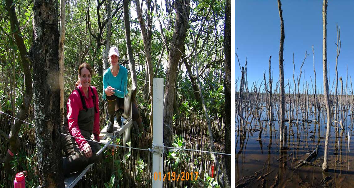
I joined the USGS team (led by Dr. Nicole Cormier) to sample both the reference and the degraded mangrove sites. An additional restored site is located across the street from the degraded site where a canal was dug to allow water flow. The reference site located on Horr’s Island was a beautiful mangrove forest, almost completely shaded under the canopy of black mangroves, while the degraded site was strikingly similar to a Salvador Dali painting. This degraded site had orange sandy soil and the remains of dead treesSurface elevation tables (SETs) are used to measure the height of the mangrove forest floor, which is mostly composed of organic peat. Each SET has a metal pole drilled down to the limestone bedrock and is secured by a cement column. To measure the elevation, a horizontal arm is attached to the pole in the ground (as seen in the picture), and vertical metal “pins” that come through the arm are placed gently on the soil. The distance from the forest floor to the horizontal arm gives the average elevation height. The purpose of this measurement is to know whether the forest floor is gaining elevation (creating more peat) or losing elevation (peat is degrading faster than replacement).
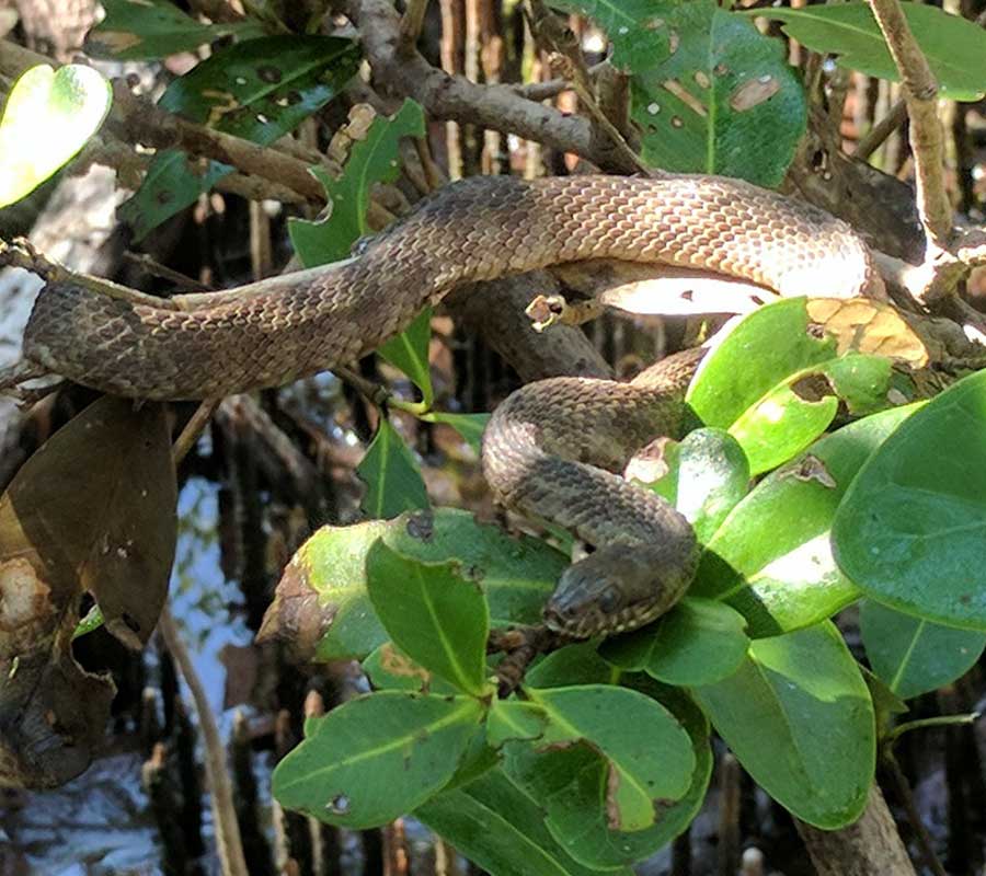
These mangrove forests are constantly inundated with a few inches of water, which is called “standing water.” Water quality measurements such as temperature, salinity, and dissolved oxygen or pH? were taken for standing water as well as groundwater extracted with a syringe. In this dry, subtropical season and without adequate water exchange with the ocean, evaporation exceeds precipitation creating hypersaline conditions. Some of the salinity readings were as high as 50 parts per thousand! For reference, typical ocean conditions are around 35 parts per thousand.Invertebrate collection involves scanning the water for fiddler crabs as well as every tree for snails. This can become the most frustrating part of the day when no one can find enough snails to meet the sample size requirement. But the long field days were not without some megafauna excitement: at Horr’s Island, a Florida Banded water snake was seen basking on top of a mangrove sapling.
At the end of the day, everyone trudges out of the muddy mangrove forest lugging their field gear and samples, and takes careful precautions to not cover their cars in mud.
Nick Roach
SWMP Water Quality Technician
Please remember, maintaining a safe distance is imperative for a successful nesting season for all of Florida’s wild life.
Rookery Bay Research Reserve
Rookery Bay National Estuarine Research Reserve stretches across 110,000 acres of pristine mangrove forest, uplands and protected waters. We are committed to preservation through research, education, and land protection.
